Photo: Lee Ann Bolton
Conservation
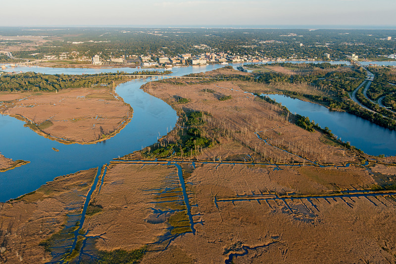
Conservation of privately held land is critical to preserving and enhancing Eagles Island’s environmental qualities. While much of the island’s acreage is not physically accessible, the scenery and wildlife habitat can be experienced from the water
Much of Eagles Island is located within the ‘Brunswick and Cape Fear River Marshes’ Natural Area, a Registered Natural Area designated by the North Carolina Natural Heritage Program (NC NHP) with a top ranking of ‘Exceptional’. Out of almost 2,500 Natural Areas in the state, only 17% achieve this highest rating. These areas are critically important for the conservation of North Carolina’s natural biodiversity and contain some of the best populations of rare species, their habitat, and natural communities in the state (NC NHP, 2020). Additionally, the Cape Fear and Brunswick Rivers surrounding and south of Eagles Island are designated by the NC NHP as the ‘Lower Cape Fear River Aquatic Habitat’ Natural Area with a top ranking of ‘Very High’. Across the Brunswick River, the ‘Sturgeon Creek Tidal Wetlands’ Natural Area is recognized by the NC NHP with a ‘Moderate’ ranking. These three Natural Areas converge at Eagles Island and, along with the myriad upstream and nearby Natural Areas, help create a connected, biologically rich corridor along the Cape Fear River.
Brunswick River and Cape Fear River Marshes
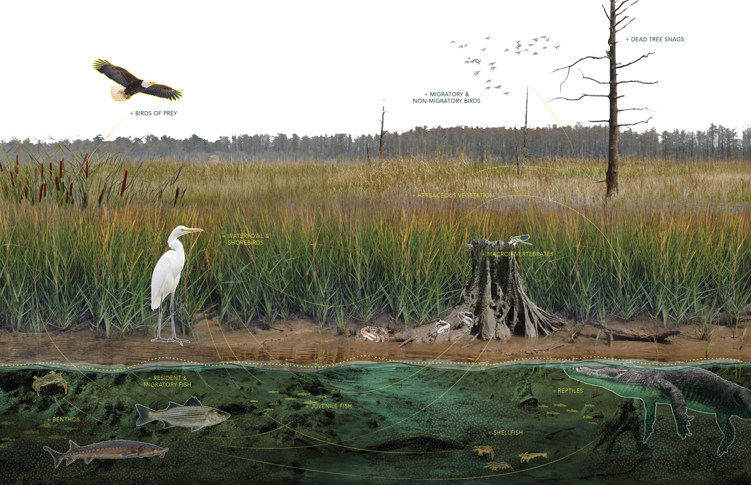
This 3,873-acre natural area contains the largest area of tidal freshwater marsh habitat in North Carolina and supports populations of the Federally and State Endangered shortnose sturgeon (Acipenser brevirostrum); Federally and State Endangered Atlantic Sturgeon (Acipenser oxyrynchus) Federally and State Threatened American alligator (Alligator mississippiensis); the only current populations in the state for rare skipper (Problema bulenta), a small butterfly listed as a Federal Species of Concern; and many other significant plant and animal species. Due to the tidal dynamics and variable salinity, the Tidal Freshwater Marsh natural community in this area contains two variants: the Oligohaline Variant, which is characterized by predominantly freshwater with very low salt content, and the Freshwater Variant, characterized by the absence of saltwater (New Hanover County Natural Area Inventory / LeBlond, 2003).
Lower Cape Fear Aquatic Habitat
The Lower Cape Fear River Aquatic Habitat includes 20,426 acres along the Cape Fear and Brunswick Rivers from Eagles Island to the mouth of the Cape Fear River. In addition to habitat for aquatic species, the river and adjacent land creates a corridor linking a number of additional natural areas. This Natural Area supports populations of four Federal and State protected species, including the West Indian manatee (Trichechus manatus), shortnose sturgeon (Acipenser brevirostrum), Atlantic sturgeon (Acipenser oxyrynchus) and the American alligator (Alligator mississippiensis) (LeBlond, 2003).
Sturgeon Creek Tidal Wetlands
This site comprises approximately 500 acres of the tidal floodplains of Mill Creek and Sturgeon Creek, with the Tidal Cypress-Gum Swamp natural community dominating upstream of the confluence and the Tidal Freshwater Marsh (Freshwater Variant) occurring downstream of the confluence. A significant feature of this Natural Area occurs where the two natural communities come together, an unusual transitional community is found where typical Cypress-Gum Swamp canopy coincides with Freshwater Marsh understory (LeBlond, 1995).